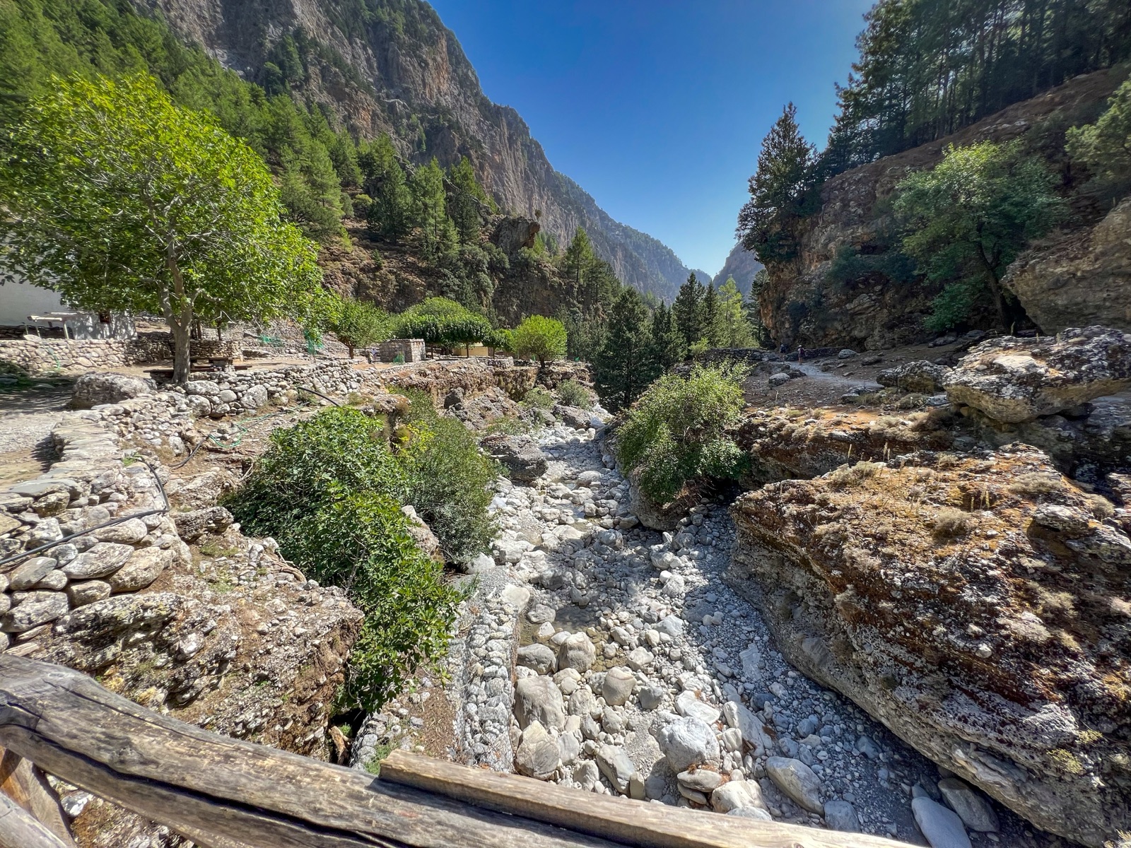
Omalos Plateau and Gingilos: Xyloskalo, the Top of the Samaria Gorge and the Walks Above It
The Omalos plateau is the high, flat basin in the White Mountains where the Samaria Gorge begins. At its southern edge is Xyloskalo, the top entrance of the gorge, and from the same car park start the paths to Gingilos, one of the most popular mountain walks in western Crete, and to the Kallergi mountain refuge. Most visitors see Omalos only from a bus window at dawn on their way into the gorge, but the plateau is worth a visit in its own right: for a night before the walk, for a summit hike with views of both Cretan seas, or as a cool escape from the coast when the gorge is closed. This guide covers the plateau, Xyloskalo, the Gingilos walk, the refuge, how to get there and when to go.
Omalos at a glance
- Height. The Region’s UNESCO-sites project gives the Omalos plateau as 1000 m above sea level, surrounded by the White Mountains, with Xyloskalo at 1250 m. Other sources differ: West-crete.com describes Omalos as the largest and most famous high plateau of western Crete, roughly circular and flat at around 1100 m, and Wikipedia gives Omalos village’s elevation as 1,041 m.
- Size. The plateau covers 15 km².
- Distance. The village of Omalos lies at the north-eastern corner of the plateau, 38 km south of Chania, and Omalos village is about 5 km from the gorge entrance at Xyloskalo.
- People. Omalos had 22 permanent residents in the 2021 census.
- Mountains. The highest summit of the White Mountains is Pachnes, 2,453 m, and there are over 30 summits above 2,000 m. The range has about 50 gorges, Samaria the most famous.
The plateau
Omalos is a mountain basin, flat-floored and ringed by peaks. Stockbreeding is the main activity; the round stone shepherds’ buildings, the mitata, produce excellent dairy products. The cool climate suits potatoes, apples and cereals, and graviera cheese is made in the mitata.
The landscape changes with the seasons. In winter the plateau is often entirely covered in snow; in spring it has countless flowers and seasonal marshes. By summer, when the gorge is open, the floor of the plateau is dry and the surrounding peaks are bare grey limestone.
Its remoteness shaped its history. Because of its remote, protected position, the plateau was a refuge for Cretan fighters during the Ottoman occupation. Near the northern entrance of the plateau stands the ‘castle’ of Hadzimihalis Giannaris, a 19th-century rebel leader, beside the chapel of Agios Pandeleimon.
A few families now live on the plateau all year to run a few hotels and tavernas, and Omalos has become a popular winter weekend outing for people from the coast, for walks in the snow and long meals. An old stone mule track links Omalos with Agia Eirini to the west, the way to the Agia Eirini Gorge.
Xyloskalo: the top of the gorge
At the southern end of the plateau the road rises to about 1230 m at Xyloskalo, on the rim where the land drops into the gorge. The park gives the altitude of the entrance as 1,227 m: the natural direction is downhill, from Xyloskalo at 1,227 m to sea level at Agia Roumeli. The small differences between sources come from where each measured.
The name tells the story of the place. Xyloskalo, ‘wooden stairs’, is named after an old staircase of cypress trunks; the trail, built by Manousos Koundouros in the late 19th century, is 2–2.5 m wide.
What you find at Xyloskalo:
- The park entrance and forest outpost. There are forest outposts at Xyloskalo and at Agia Roumeli. Keep your ticket to be checked at the exit, so the rangers know everyone who entered has left.
- The information centre. The gorge starts at Xyloskalo, at an altitude of 1250 m, where paths to the surrounding peaks such as Gingilos also start, and where the park’s information centre stands. The information centre at Omalos, with an exhibition on the protected area, is free to visit.
- A café and parking. A SummitPost route page notes that the Gingilos path starts just above the park entrance, so no gorge ticket is needed, and parking there is free.
- Free helmets. Free helmets are provided at both entrances; wearing one is optional but strongly recommended.
For the walk down the gorge itself, see our walking guide.
Getting to Omalos
By bus. KTEL buses leave Chania for Xyloskalo every day at 05:00, 07:45 and 08:45, and the public bus from Chania to Omalos takes about 60 minutes. Public buses go from Chania to Omalos every morning, only when the gorge is open, so outside the season you need a car or a taxi. A bus also leaves Sougia for Xyloskalo every day at 07:00.
By car. By car Xyloskalo is about 1–1.5 hours from Chania, and the car cannot be collected at the exit. The road climbs through Lakki: Lakki, with a few cafés and small tavernas, is the last village on the road to Omalos. On clear days the road up gives views of the north coast from Akrotiri and Chania to the Rodopou and Gramvoussa peninsulas; stop only in a safe place. Main roads into the White Mountains run from the north to Omalos, with other approaches from Sougia and Paleochora in the west. The by car guide explains parking and how to get back to your car after the gorge.
On a tour. Organised Samaria tours climb to Omalos by coach; the full-day trek from Chania includes a coach to Omalos in the White Mountains and breakfast. See our tours page.
The Gingilos walk
Gingilos is the great rock peak that rises straight above Xyloskalo, west of the gorge entrance. It is the most accessible summit walk in western Crete, because the path starts right by the car park.
The height question. You will see two numbers. West-crete.com gives the summit of Gingilos as 1980 m, not the 2080 m on the signs at the start. Many maps and guides use 2080 m; the local walking site argues the signs are mistaken. Either way, it is a real mountain walk.
Gingilos in numbers
| Start | Xyloskalo, about 1230 m |
| Total ascent | a little over 800 m |
| Walking time | about 5 to 6 hours, there and back |
| Water | Linoseli spring only |
| Saddle | 1700 m |
| Ticket | none: the path starts outside the park gate |
From Xyloskalo at 1230 m the total ascent is a little over 800 m, and the walk returns the same way and takes about 5 to 6 hours in all.
The route, step by step
- The zigzags. The path starts beside the café above the gorge entrance and climbs a zig-zag for about 30 minutes. Behind you, the plateau of Omalos opens out.
- The traverse. The path levels off and contours round the mountain. On the way the path passes ancient cypresses, a large arch and tall rock spires.
- Linoseli spring. The Linoseli spring, always very cold, is the only water on the way. Fill up here.
- To the saddle. Above the tree line the path climbs through rock and scree. From the spring the path reaches a saddle at 1700 m in about 30 to 45 minutes. From the saddle the view opens to the south over the Libyan Sea.
- To the summit. From the saddle to the summit takes about 45 to 60 minutes, on a marked route where you need your hands in a few places. Many walkers stop at the saddle; the last part needs more experience.
- The views. From the summit you see Chania and the Aegean to the north, the Libyan Sea and Gavdos to the south, and Pachnes (2,453 m) across the gorge. To the south rises Volakias (2,116 m), higher than Gingilos itself.
How hard is it?
The path is well marked to the saddle but very rocky, and needs good walking shoes. It is a steady climb rather than a scramble until the saddle; the summit section is steeper and needs care. The descent is long and hard on the knees. On a busy day perhaps 50 people walk it, rarely more, so it is far quieter than the gorge.
When to climb Gingilos
On dry trails, usually free from snow from late June to late November, only hiking shoes are needed. In spring there can be snow on the upper path, and the route can be dangerous where it crosses steep slopes. Weather can change suddenly, generally coming from the west; high winds and fog above the saddle are dangerous, so turn back. The emergency number is 112.
What to bring
- Sturdy walking shoes or boots with good grip.
- At least one full bottle from the start, refilled at Linoseli.
- A windproof layer: the saddle and summit can be cold and windy even when the plateau is warm.
- Sun hat and sunscreen; above the trees there is no shade.
- Food for the day: there is nothing on the mountain.
The Kallergi refuge
East of the plateau, on the ridge above the gorge, is the mountain refuge run by the Chania mountaineering club. The Greek Mountaineering Club of Chania gives the Kallergi shelter’s altitude as 1,680 m, with room for 50 people. The Region’s UNESCO-sites page gives the refuge as 1650 m, founded in 1970, with room for 45 people.
- Getting there. It can be reached by car from Omalos on a 5 km dirt road, or on a 1.5-hour hike from Xyloskalo, suggested from April to October.
- Opening. The shelter opens all year at weekends, and on other days by arrangement.
- The view. From the refuge the view takes in the Samaria Gorge, the Libyan Sea and the peaks of Gingilos, Volakias, Melidaou and Pachnes.
- The trails. It stands above Omalos on the European E4 trails, with views over the Samaria Gorge.
The walk to Kallergi is a good half-day alternative to Gingilos: less climbing, a clear goal, and a view straight down into the gorge.
Other walks from the plateau
- The first kilometres of the gorge. You can also walk just a few kilometres in from Xyloskalo, but the return is tiring because the path is steep. After 13:00, visitors may walk only the first 2 km from either entrance.
- Longer mountain routes. It is a starting point for longer walks towards Kallergi and for the summits of Gingilos and Psilafi. These need mountain experience, maps and settled weather.
- Around the plateau. The flat floor of Omalos is easy walking, with shepherds’ huts and wide views of the peaks, and makes a gentle evening stroll if you are staying overnight.
How the plateau and the gorge fit together
Standing at Xyloskalo, you are looking into the head of a long canyon that runs south through the mountains to the sea. The gorge was carved by a small river between the White Mountains and Mount Volakias, and the peak you see to the south from Gingilos is that same Volakias. The 18 km sometimes quoted is the distance from the settlement of Omalos to Agia Roumeli; the walk from the gate itself is about 16 km.
The park around you is old by Greek standards. The gorge became a national park in 1962, especially as a refuge for the rare kri-kri, the Cretan wild goat, and UNESCO has designated the gorge a Biosphere Reserve. The same year, the village of Samaria, inside the gorge, was abandoned by its last inhabitants; the village and the gorge are named after its ancient church, Ossia Maria. The plateau, with its shepherds and summer fields, gives you a sense of how people lived in these mountains before the park.
A sample day on the plateau
If you have a car, or are staying overnight, Omalos makes a full day without entering the gorge:
- Early morning. Watch the first walkers set off down the Xyloskalo zigzags, then start up the Gingilos path while the air is still cool.
- Mid-morning. Fill your bottle at Linoseli and climb to the saddle for the first view of the Libyan Sea.
- Late morning. Go on to the summit if you are confident on rock, or turn back at the saddle.
- Afternoon. Lunch at a taverna on the plateau, then visit the free information centre to learn about the park’s plants and animals.
- Evening. A short walk across the flat plateau floor as the light goes, and an early night if you are walking the gorge the next day.
Mountain safety
The mountains around Omalos are higher and more exposed than the gorge, and help is further away. A few rules:
- Tell someone your plan, and when you expect to be back.
- Turn back early if cloud comes down or the wind rises; the summit section of Gingilos is no place to be in fog.
- Do not leave the marked route to take a short cut, especially on the way down.
- Carry more water than you think, because Linoseli is the only spring.
- Save the emergency number: the emergency number is 112.
Staying on the plateau
To avoid the early-morning bus, you can stay the night before in a hotel at Omalos. Rooms are few and simple, and in summer they fill with walkers, so book ahead. Staying on the plateau means you can be at the gate when it opens, ahead of the buses and coaches. Our where to stay guide compares Omalos with Chania and the south coast.
When to visit Omalos
- May and June. The gorge is open, the plateau is green, and flowers are out on the surrounding slopes.
- July and August. The plateau stays cooler than the coast, which makes it a pleasant place to sleep before the walk. Gingilos is usually snow-free.
- September and October. Clear autumn days are ideal for Gingilos and Kallergi; watch for the first storms. The gorge can close for a day or more if rain or a heatwave is expected; the decision is taken the day before.
- November to April. The gorge is closed and buses do not run, but the plateau is a winter destination for local people, with snow on the peaks and sometimes on the plateau itself.
Check our weather page for the forecast at Xyloskalo, and the best time to visit guide for the gorge season.
Combining Omalos with the gorge
- Night on the plateau, gorge next day. The classic combination: arrive in the afternoon, walk to Kallergi or around the plateau, sleep, and walk down the gorge at opening time.
- Gingilos one day, gorge the next. Fit walkers can climb Gingilos on the first day and walk the gorge on the second, from the same base.
- A plateau day when the gorge is closed. If the park closes the gorge for weather, Omalos can still be a good day out, but do not climb high in storms or wind.
Frequently asked questions
How high is the Omalos plateau? Sources give between 1000 m and about 1100 m for the plateau floor, and about 1230 m to 1250 m for Xyloskalo at its edge.
Do I need a ticket for Gingilos? No. The path starts just above the park entrance, outside the gorge.
How long does Gingilos take? About 5 to 6 hours there and back, with a little over 800 m of ascent.
Is there water on Gingilos? Only at the Linoseli spring, part-way up. Carry enough for the whole day.
Can I sleep at Omalos? Yes, in a few family-run hotels and rooms on the plateau. Book ahead in summer.
Is the Kallergi refuge open every day? It opens at weekends all year, and on other days by arrangement with the club.
Can I visit Omalos in winter? Yes, by car, but the gorge is closed and the plateau can be under snow.